SOUTHERN UTAH, A LAND OF STARK BEAUTY: Part 2 - Zion Canyon
Almost at Zion Canyon. Click on photo to enlarge.
The free shuttle ran every 10 minutes, stopping at different trails to allow folks to get off and on. We did this a lot. Because we've traveled together often, Ron, Bob, and Nita know I'm a nutty photographer; they graciously put up with me and my camera.
The visitor center and its numerous shuttles.
Picture taken through window on the shuttle's roof. I took lots of these.
Thousands of years ago the canyons of Zion were created by the Virgin River and the spring rains that brought waterfalls cascading through the huge rocks. Flash floods are common, especially in the spring, and you are warned to check weather conditions before coming to Zion Canyon. Even distant storms can cause flash floods. Scientists believe that the Virgin River can still erode 1,000 feet of vertical bedrock.
I liked seeing the American flag at the visitor's center.
One of my favorite pictures. The white peaks
in the center remind me of white chocolate candy kisses.
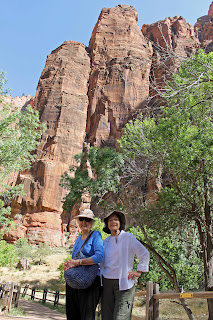
Sister-in-law Nita and I bought these hats
at Walmart in Washington. Hers is cute and
stylish; mine is floppy and kind of ugly, but it
protected my face and the back of my neck.
This squirrel begged unsuccessfully for food. Squirrels
and other wildlife can become aggressive if you
succumb to their charms.
Maidenhair ferns (above) grow in small pockets of moist dirt and cling to the rock faces, often appearing to grow out of the rock.
The above photo explains the swamp in the desert.
Can you spot the buck standing right beside the trail?
The Virgin River, peaceful the day we visited, but it
can turn into a roaring, dangerous river in minutes.
Weeping Rock.
We climbed a short, but steep trail with what is called "minor" drop-offs to reach Weeping Rock. Hah! I didn't consider them "minor" at all, but I have a fear of heights. The view at the top was worth it, however, and seeing the live rattlesnake about six inches off the trail made it more exciting.
This bird, possibly a black-headed grosbeak, posed long
enough for me to snap a quick picture. Bless his heart.
Cottonwood, singleleaf ash, and boxelder live near the Virgin River.
Zion Canyon captured my heart, and I hated to leave. But we were all tired, hot, and hungry, so we caught the shuttle back to the Zion Visitor Center and our car, and drove the 42 miles back to our condo. What a great day!
Labels: Utah, Virgin River, Zion Canyon


0 Comments:
Post a Comment
<< Home